A Mid-Northern Summer/Southern Winter's Mars
MGS MOC Release No. MOC2-325, 04 April 2003
The Mars Global Surveyor (MGS) Mars Orbiter Camera (MOC) began its daily global imaging campaign four years ago, on March 9, 1999. Since that time, slightly more than 2 full Martian years have elapsed, and MOC has obtained a complete daily record of the red planet's ever-changing weather patterns. Observing Mars every day over many years is critical to understanding how to forecast weather that may occur in the future, and MOC is the only U.S. instrument slated to orbit Mars until late 2006 that can provide this information. For example, the MOC team has found that many weather events repeat from one year to the next. Such knowledge is useful in considering where future spacecraft might land on Mars---a site that is known to experience a dust storm each year during the period a lander or rover will be operational might not be a good place to land.
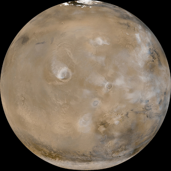
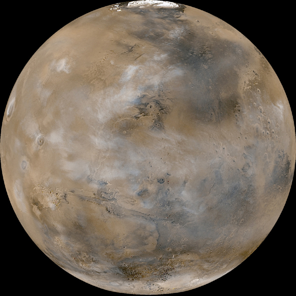
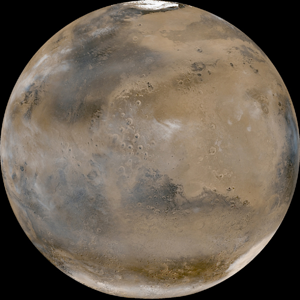
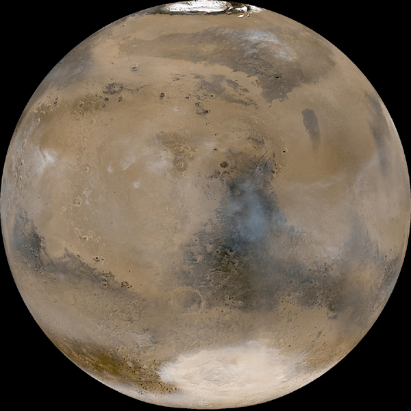
The six views of Mars shown here are a composite of the 24 daily global images acquired by MOC on February 14, 2003. At this time, it was the middle of summer in the northern hemisphere, and the middle of winter in the south. Taken together, the six views show the entire planet, its albedo (bright and dark) features, polar frosts, and cloud patterns. Water-ice clouds dominate the martian atmosphere over the tropical and sub-tropical latitudes, while orographically-generated (i.e. those associated with high-standing topography) water-ice clouds hang over each of the large volcanoes of the Tharsis and Elysium regions (see MOC2-326a, MOC2-326b, MOC326f).
In the north polar region, the residual water-ice cap is fully exposed. In the southern hemisphere, the winter-time seasonal carbon dioxide frost cap can be seen, extending from the south pole (which is in darkness and not seen in these images) northward to 50°S latitude. In the deep Hellas Basin (an ancient, giant impact scar seen as the bright elliptical feature at the bottom of MOC2-326e), the winter-time cap extends northward to 31°S because the lower elevation permits carbon dioxide to freeze at slightly higher temperatures than at the high elevations elsewhere in the southern hemisphere.
When these pictures were taken on February 14, 2003, dust storm activity was at a minimum and isolated to early morning hours around the edges of the north polar cap. Within a day, however, dust storm activity began to pick up in both hemispheres--as was expected from previous MOC images at this time of year in 1999 and 2001--and dust storms remained active through the rest of February and March.
Images Credit: NASA/JPL/Malin Space Science Systems
Caption by: B. C. Cantor, K. S. Edgett, and M. C. Malin, MSSS
|