|
|
 |
| Martian Terrain |
 |
02-Aug-2007
|
View Related
Spacecraft Images
|
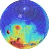 |
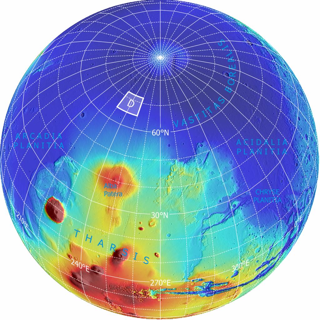
Far-Northern Destination for Phoenix Mars Lander
The planned landing site for NASA's Phoenix Mars Lander lies at a latitude on Mars equivalent to northern Alaska on Earth. It is within the region designated "D" on this global image.
This is an orthographic projection with color-coded elevation contours and shaded relief based on data from the Mars Orbiter Laser Altimeter on NASA's Mars Global Surveyor orbiter. Total vertical relief is about 28 kilometers (17 miles) from the top of the highest volcano (red) to the northern lowlands (blue). North pole is where the longitude lines converge.
Image credit: NASA/JPL-Caltech/Washington Univ. St. Louis/Univ. of Arizona
|
Browse Image |
Medium Image (183 kB) |
Large (1.2 MB)
Full Resolution (3.2 MB)
|
|
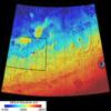 |
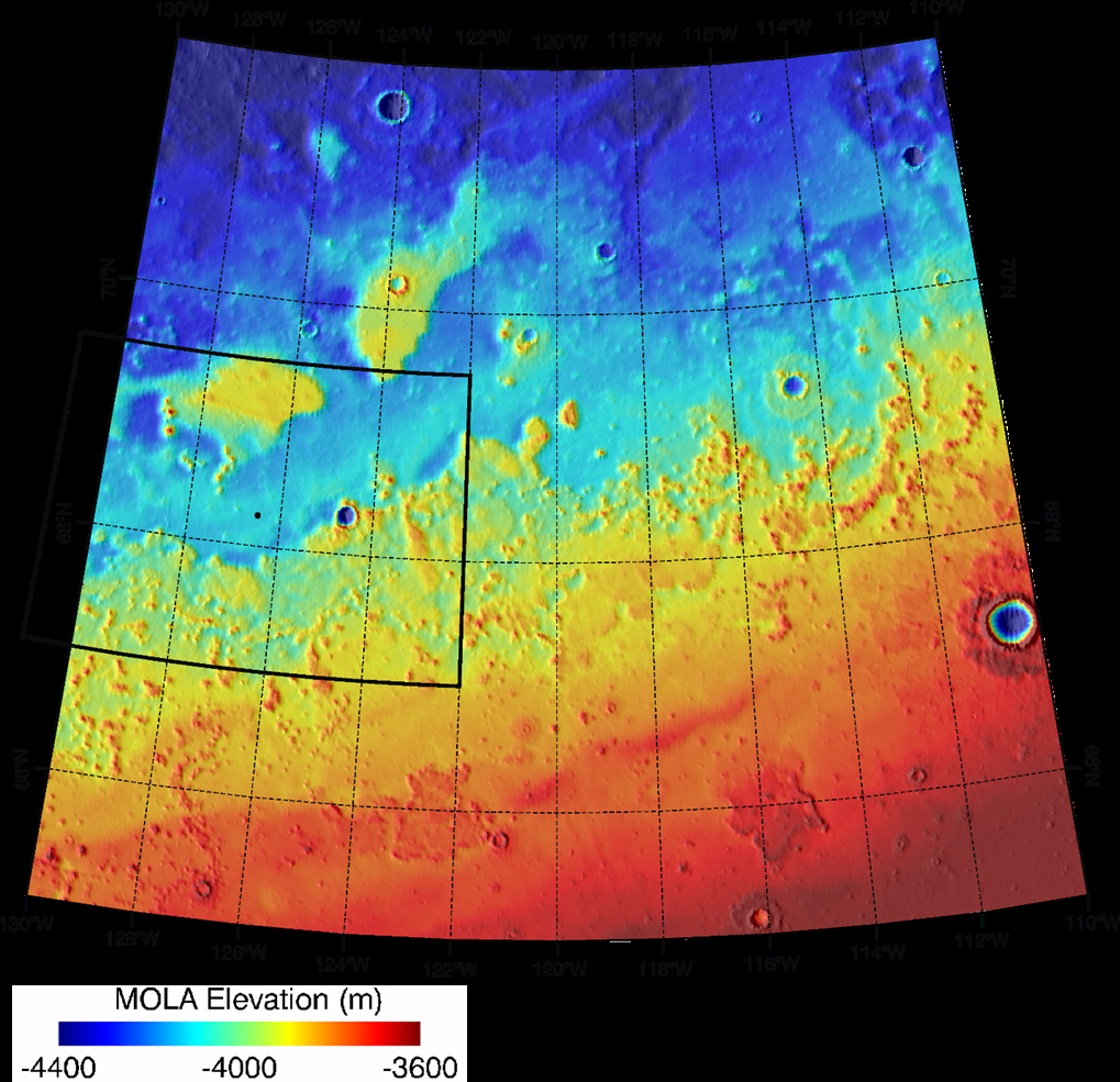
Topographical Context of Phoenix Landing Region
Color coding indicates the topography in this map of the region of Mars from 65 to 72 degrees north latitude and from 230 to 250 degrees east longitude. This area was designated "Region D" in the process of evaluating potential landing sites for NASA's Phoenix Mars Lander. The location chosen for safe landing sites is within the box bordered with a heavy black line along the western boundary of this region.
Elevation in the region varies from about 3,600 meters (11,800 feet) to 4,400 meters (14,400 feet) below the zero reference point for Martian surface elevation. The topographical information is from the Mars Orbiter Laser Altimeter on NASA's Mars Global Surveyor orbiter.
Image credit: NASA/JPL-Caltech/Washington Univ. St. Louis/Univ. of Arizona
|
Browse Image |
Medium Image (132 kB) |
Large (761 kB)
Full Resolution (2.3 MB)
|
|
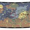 |
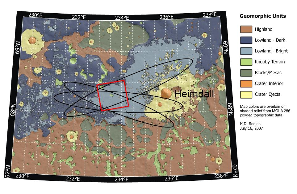
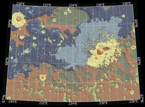
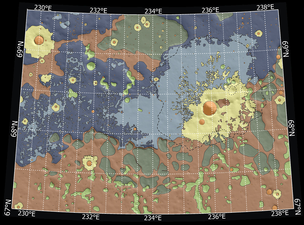
Possible Landing Ellipses for Phoenix
Launch date makes a difference in the orientation of ellipses marking where NASA's Phoenix Mars Lander will have a high probability of landing, given the planned targeting for the spring 2008 landing site. This map shows possible landing ellipses for the Aug. 3, 2007, opening of the launch period (the ellipse oriented northwest to southeast) and for launch dates at the middle and end of the three-week period of launch opportunities.
The map also shows a color-coded interpretation of geomorphic units -- categories based on the surface textures and contours. The yellow-coded area surrounding a crater informally named "Heimdall" appears to have even fewer boulders on the surface than other units. The geomorphic mapping is overlaid on a shaded relief map based on data from the Mars Orbiter Laser Altimeter on NASA's Mars Global Surveyor orbiter. The red box indicates the location of an image from the Context Camera on NASA's Mars Reconnaissance Orbiter.
Image credit: NASA/JPL-Caltech/Washington Univ. St. Louis/JHU APL/Univ. of Arizona
|
Labeled
|
Browse Image |
Medium Image (125 kB) |
Large (519 kB)
Full Resolution (1.7 MB)
|
Unlabeled
|
Browse Image |
Medium Image (143 kB) |
Large (898 kB)
Full Resolution (1.7 MB)
|
|
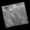 |
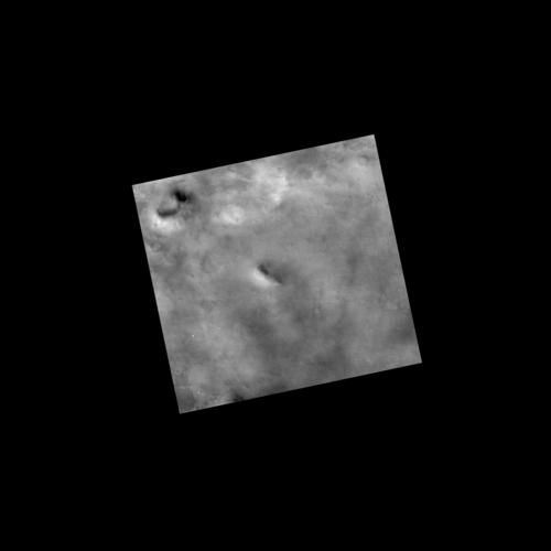
Context Image of Planned Landing Site
This view covers an area about 27 kilometers (17 miles) wide within the planned landing area for NASA's Phoenix Mars Lander. It was taken by the Context Camera on NASA's Mars Reconnaissance Orbiter and catalogued as image P02_001893_2485_XI_68N126W_061221 from that instrument.
Note the crater near the top (north) of the image. The red box indicates the position of a higher-resolution image of ground texture in this area.
Image credit: NASA/JPL-Caltech/MSSS
|
Browse Image |
Medium Image (26 kB) |
Large (700 kB)
Full Resolution (2.0 MB)
|
|
 |
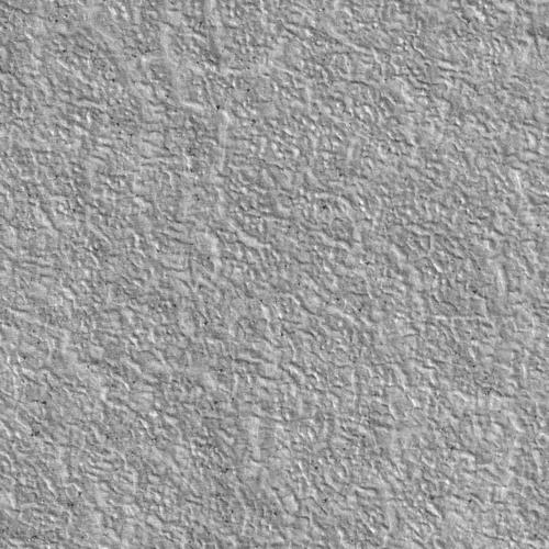
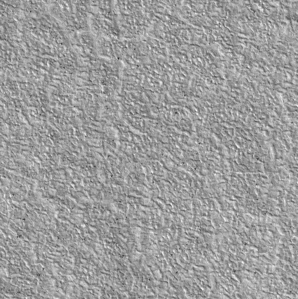
Sweet Spot for Landing on Mars
This view shows scattered rocks and a polygonal ground texture within the "sweet spot" of the planned landing area for NASA's Phoenix Mars Lander.
This is a subframe, covering a patch of ground about 250 meters (820 feet) across, from a larger image taken by the High Resolution Imaging Science Experiment (HiRISE) camera on NASA's Mars Reconnaissance Orbiter on Jan. 1, 2007. The full image, catalogued as HiRISE image PSP_002170_2485, , is centered at latitude 68.3 degrees north latitude, 232.9 degrees east longitude.
Image credit: NASA/JPL-Caltech/Univ. of Arizona
|
Browse Image |
Medium Image (220 kB) |
Large (776 kB)
Full Resolution (1.6 MB)
|
|
JPL Image Use Policy
|


