Jet Propulsion Laboratory JPL Earth JPL Solar System JPL Stars and Galaxies JPL Science and Technology MRO Home NASA Home Page Jet Propulsion Laboratory California Institute of Technology Follow this link to skip to the main content
Jet Propulsion Laboratory
+ NASA Homepage
+ NASA en Español
+ Marte en Español
Search Mars
Go Search
Mars Reconnaissance Orbiter
Overview Science Technology The Mission People Features Events Multimedia
Mars for Kids
Mars for Students
Mars for Educators
Mars for Press
+ Mars Home
+ MRO Home
Multimedia
Summary
Images
Videos
Videos


  2009
screen shot from movie 'Mars Exposed - How meteorites uncovered a Martian secret'
Mars Exposed - September 24, 2009

How meteorites uncovered a Martian secret.

QuickTime (captioned) 18.9 MB    |    QuickTime (Large - 1280x720) 155.5 MB
screen shot from movie 'Looking at Landing Sites for the Mars Science Laboratory - May 27, 2009'
Looking at Landing Sites for the Mars Science Laboratory - May 27, 2009

The prime responsibility of the Mars Reconnaissance Orbiter has been to search out new landing sites for future missions.

QuickTime 22.3 MB    |    QuickTime (captioned) 24 MB
MPEG-4 (640x360) 52.3 MB    |    QuickTime (Large - 1280x720) 132 MB
screen shot from movie 'Soaring Over Mars - May 27, 2009'
Soaring Over Mars - May 27, 2009

The Mars Reconnaissance Orbiter has seen many places on the planet. One of the most interesting is one of the great canyon systems on Mars.

QuickTime 31 MB    |    QuickTime (captioned) 33.4 MB
MPEG-4 (640x360) 40.6 MB    |    QuickTime (Large - 1280x720) 120 MB
screen shot from movie 'Weather Movie, Mars South Polar Region, March-April 2009 - Close'

screen shot from movie 'Weather Movie, Mars South Polar Region, March-April 2009 - Far'
Weather Movies, Mars South Polar Region, March-April 2009

These movies show the southern hemisphere of Mars from March 19 through April 14, 2009, a period when regional dust storms occurred along the retreating edge of carbon-dioxide frost in the seasonal south polar cap.

Each movie combines hundreds of images from the Mars Color Imager (MARCI) camera on NASA's Mars Reconnaissance Orbiter.

Image credit: NASA/JPL-Caltech/MSSS


Download Options with Full Caption

Related Press Release  |   Related Image

  2008
Carbon-Dioxide Frost Settling from Seasonal Outbursts on Mars (Movie)
Peeling Back Layers of a Martian Polar Ice Cap

This artist's animation illustrates how NASA's Mars Reconnaissance Orbiter used radar to map the insides of the north polar ice cap on Mars.
The animation begins by showing the orbiter flying above the Red Planet. It then shows the orbiter shooting out beams of radio waves across a slice of the ice cap. The waves, which belong to the radio portion of the electromagnetic spectrum, penetrate through the ice and bounce back at different times depending on the differing concentrations of sand and dust in the ice.

The result is a glimpse inside the layers that make up the ice cap, as demonstrated by the next part of the movie. The ice cap slices open to reveal what the scientists found. Flashing green lights show some of the actual radar reflections, subsequently seen as dark lines delineating the layers. While the uppermost thin layers were observed before in camera images, the deeper layers have been discovered by the Mars Reconnaissance Orbiter. The movie ends by showing the radar image by itself.

These observations demonstrate that radar can be used to study the history of global climate on Mars by revealing the patterns of deep layering. They also expose a flat boundary between the ice cap and the surface of Mars, indicating that the outer strong shell of Mars must be thick enough to support the weight of the ice cap without sagging. This, in turn, suggests that the planet's outer shell, called the lithosphere, is colder than previously thought, with temperatures in the interior increasing gradually with depth. Any bodies of liquid water that might exist underneath Martian ground must therefore be deeper than previously calculated, where temperatures are warmer.

This artist's animation is based on data from the Shallow Radar instrument on Mars Reconnaissance Orbiter, as well as images from NASA's Mars Global Surveyor mission.

The Shallow Radar instrument was provided by the Italian Space Agency. Its operations are led by the University of Rome and its data are analyzed by a joint U.S.-Italian science team. JPL, a division of the California Institute of Technology, Pasadena, manages the Mars Reconnaissance Orbiter for the NASA Science Mission Directorate, Washington.

Image credit: NASA/JPL-Caltech/University of Rome/SwRI


QuickTime 1.97 MB    |    QuickTime 20.9 MB

Related Press Release

Related Images

  2007
Carbon-Dioxide Frost Settling from Seasonal Outbursts on Mars (Movie)

This movie, constructed by overlaying a time series of images taken by the Compact Reconnaissance Imaging Spectrometer for Mars (CRISM), shows seasonal changes and unearthly processes that occur in Mars' south polar seasonal frost cap.

Mars' seasonal caps consist of frozen carbon dioxide mixed with smaller amounts of water ice frost and dust. The different composition of Mars' seasonal caps than Earth's seasonal caps (water-ice snow), plus the lower pressure of the Martian atmosphere, inevitably make springtime recession of the seasonal cap different than the snowmelt that characterizes retreat of Earth's seasonal cap. To monitor Mars' seasonal changes, CRISM repeatedly targets specific regions as Mars' seasons change. Results shown here are evidence that as warming carbon-dioxide ice vaporizes, some is trapped under the ice slab from which pressurized outbursts occur. The released gas expands, cools, and some of it refreezes and falls back to the surface as bright fans.

The region shown in this movie, known informally as Manhattan, is located at 86.3 degrees south latitude, 99 degrees east longitude. To represent the content of the spectral images, two versions of the data are shown side-by-side. The left image was constructed from extended visible wavelengths, to look similar to color images from the High Resolution Imaging Science Experiment (HiRISE) camera. The right image is infrared false-color, with red being the reflectance at 1.30 micrometers, green being depth of the water ice absorption centered at 1.5 micrometers, and blue being depth of the carbon dioxide ice absorption centered at 1.435 micrometers. In this color scheme, surfaces with higher water ice content will appear greenish, while bright carbon dioxide ice will appear magenta. Areas covered by dust will appear dark. In both images, north is to the right. The four time steps in the movie were taken at solar longitudes (Ls) ranging from 195 through 226. (Solar longitude is a measure of seasons, where 180 is southern spring equinox and 270 is southern summer solstice.)

The first frame shows a number of spots and dark fan-shaped features, with a higher concentration of spots on a slope in the middle of the scene. The dark fans show multiple directions, generally indicating wind coming out of the east. The second frame was taken just a few days after the prior one and starts to show color variations in the fans.

The third frame records appearance of bright (bluish) fans in addition to the dark fans. The bright fans are slightly more bluish in the false-color image at right, indicating enrichment in carbon dioxide ice. The tails of the dark fans are more greenish, indicated a slight enhancement of water ice. The fourth and final frame shows distinct bright fans that appear magenta in the false-color image, indicating carbon dioxide ice with little evidence of water ice. However the surrounding surface is greenish, suggesting small amounts of water ice contamination. The tails of the dark fans appear to be more greenish in the infrared than the surrounding ice, suggesting a slight enhancement of the water ice contamination. The difference between the directions of dark and bright fans suggests changes in the wind direction, perhaps as part of a diurnal cycle or pattern.

CRISM science team members working with these data believe that they are seeing evidence for a process first proposed based on data from the Thermal Imaging System (THEMIS) instrument on Mars Odyssey. In this hypothesis, sunlight penetrating the ice warms the underling soil and causes carbon dioxide frost to vaporize at its base. At first the gas is trapped under the frost; when it is released, the expanding gas cools and part of it refreezes to form carbon dioxide frost in the magenta-colored fans.

The Compact Reconnaissance Imaging Spectrometer for Mars (CRISM) is one of six science instruments on NASA's Mars Reconnaissance Orbiter. Led by The Johns Hopkins University Applied Physics Laboratory, the CRISM team includes expertise from universities, government agencies and small businesses in the United States and abroad. CRISM's mission: Find the spectral fingerprints of aqueous and hydrothermal deposits and map the geology, composition and stratigraphy of surface features. The instrument will also watch the seasonal variations in Martian dust and ice aerosols, and water content in surface materials . leading to new understanding of the climate.

Image credit: NASA/JPL-Caltech


QuickTime 1.02 MB

Press Release and Related Images

Still Image Frames: Frame 1 | Frame 2 | Frame 3 | Frame 4
Screenshot from the movie 'Video Candidate for a Mars Landing' Video Candidate for a Mars Landing - Oct 11, 2007

The High Resolution Imaging Science Experiment in orbit around Mars has examined many possible landing sites for the 2009 Mars Science Laboratory rover, including the Nili Fossae area seen here.

Image Credit: NASA/JPL-Caltech/Univ.of Arizona

QuickTime 15 MB   |   QuickTime (captioned) 15 MB
MPEG4 15 MB   |   QuickTime (HighRes) 22 MB

Press Release and Related Images

Screenshot from the movie 'Video Exploration of Details in Athabasca Valles on Mars' Video Exploration of Details in Athabasca Valles on Mars - Sep 20, 2007

This video provides zoom and pan moves to emphasize the context and features of a Martian valley named Athabasca Valles, perhaps the youngest outflow channel on Mars. The detailed view comes from an image taken by the High Resolution Imaging Science Experiment (HiRISE) camera on NASA's Mars Reconnaissance Orbiter on April 4, 2007.

Features in this and other images reveal that Athabasca Valles is entirely draped by a thin layer of lava. This requires that a fissure eruption fed a large volume of lava through the channels in geologically recent times. Most of the scene is covered by dust, but a few areas appear blue (in exaggerated color) where rocks and sand are exposed.

The location of the terrain explored in this video is at about 10 degrees north latitude, 156 degrees east longitude. The HiRISE source image is catalogued as PSP_003294_1895.

Image Credit: NASA/JPL-Caltech/Univ.of Arizona

No Audio

QuickTime
320x180 5.56 MB   |   480x270 9.57 MB   |   640x360 25.3 MB

Screenshot from the movie 'Simulated Flight over Gullied Crater' Simulated Flight over Gullied Crater - Sep 20, 2007

This video uses three-dimensional modeling of a gullied crater in the Centauri Montes region of Mars and simulates a flight over that landscape. One gully inside the crater has a deposit of light-toned material that was not present in 1999 but appeared by 2004, as determined from before-and-after images taken by the Mars Orbiter Camera on NASA's Mars Global Surveyor. The deposit is several hundred meters or yards long.

The imagery and stereo information for this video come from images taken on Dec. 12, 2006, by the High Resolution Imaging Science Experiment (HiRISE) camera and the Context Camera (CTX) on NASA's Mars Reconnaissance Orbiter. The HiRISE image is catalogued as PSP_001714_1415.

The location of this crater is at about 38 degrees south latitude, 97 degrees east longitude.

Image Credit: NASA/JPL-Caltech/Univ.of Arizona/MSSS/USGS

No Audio

QuickTime
320x180 2.33 MB   |   480x270 5.81 MB   |   640x360 11 MB

Screenshot from the movie 'Video Exploration of Details in Martian North Polar Layered Deposits' Video Exploration of Details in Martian North Polar Layered Deposits - Sep 20, 2007

This video provides zoom and pan moves to emphasize the context and features of layered deposits near the north pole of Mars. The detailed view comes from an image taken by the High Resolution Imaging Science Experiment (HiRISE) camera on NASA's Mars Reconnaissance Orbiter on Dec. 12, 2006.

Patterns in the layering of this ice-rich material provide clues to global climate variations on Mars.

The location of the terrain explored in this video is at about 87 degrees north latitude, 93 degrees east longitude. The HiRISE source image is catalogued as PSP_001738_2670.

Image Credit: NASA/JPL-Caltech/Univ.of Arizona

No Audio

QuickTime
320x180 5.84 MB   |   480x270 17.5 MB   |   640x360 21.3 MB

Screenshot from the movie 'Flying Over Opportunity's Work Site' Mars Rovers Battle Severe Dust Storm - July 20, 2007

Whopper dust storms on Mars are whipping up potential problems for the twin Mars rovers, Opportunity and Spirit. Opportunity in particular is getting less power from the sun because it's blocked by a dusty haze. To conserve Opportunity's power supply, engineers at NASA's Jet Propulsion Laboratory in Pasadena, California, have told the rover to conduct only essential operations. Once the storm subsides, the plan is to have Opportunity descend into Victoria Crater, which could be a site of intriguing science discoveries.

Huge dust storms whip around Mars every 5 to 6 years. Scientists hope the rovers will weather this latest storm, and in fact, that they will learn a lot about Martian dust storms from observations made by the rovers, by NASA's orbiting Mars Odyssey and Mars Reconnaissance Orbiter, and by the European Mars Express spacecraft.

QuickTime captioned 24.6 MB
QuickTime 37.9 MB
MP4 78.6 MB

Press Release and Related Animations
Screenshot from the movie 'Flying Over Opportunity's Work Site' Flying Over Opportunity's Work Site - March 13, 2007

Images of "Victoria Crater" in Mars' Meridiani Planum region, taken by the High Resolution Imaging Science Experiment camera on NASA's Mars Reconnaissance Orbiter, provided detailed, three-dimensional information that was used to create this animation of a hypothetical flyover. NASA's Mars Exploration Rover Opportunity reached the edge of this crater in September 2006 and began exploring its rim clockwise.

Victoria is about 800 meters (one-half mile) in diameter. This animated flyover approaches the crater from the south, and then moves counterclockwise around part of the rim. An enhanced glimpse of Opportunity appears at a location where the rover was seen by the orbiter.

Credit: NASA/JPL/University of Arizona/U.S. Geological Survey

QuickTime (no audio) 1.2 MB   |   QuickTime (no audio) 2.76 MB
QuickTime(no audio) 4.97 MB
Screenshot from the movie 'Flying Over Spirit's Work Site' Flying Over Spirit's Work Site - March 13, 2007

Images of the "Columbia Hills" region inside Mars' Gusev Crater, taken by the High Resolution Imaging Science Experiment camera on NASA's Mars Reconnaissance Orbiter, provided detailed, three-dimensional information that was used to create this animation of a hypothetical flyover. NASA's Mars Exploration Rover Spirit has been exploring this range of hills since 2004.

Credit: NASA/JPL/University of Arizona/U.S. Geological Survey

QuickTime (no audio) 2.23 MB   |   QuickTime (no audio) 4.41 MB
QuickTime (no audio) 7.38 MB

  2006
Screenshot from the movie 'Seeing Mars Better Than Ever' Seeing Mars Better Than Ever - October 17, 2006

NASA's newest Mars spacecraft, the Mars Reconnaissance Orbiter, is providing an unprecedented view of the surface of Mars.

QuickTime Small 7.5 MB   |   MPEG-4 7 MB
QuickTime with Caption 7.5 MB
In this animation, Mars Reconnaissance Orbiter, set against the black of space and the muted orange of Mars, rotates to get into position for imaging.  As the craft turns, the point of view zooms toward the instrument deck, where the viewer gets a close-up view of the context imager.  Then, a rectangular strip of the planet is highlighted, indicating the area that the context imager first imaged.  The remainder of the animation is a pan down the entire first context image (black and white), which features many large and small craters. Mars Reconnaissance Orbiter Context Imager Instrument Pointing Simulation - May 01, 2006

This animation highlights the orbiter's context imager as it took and returned its first image.

No Audio
QuickTime 5 MB   |   MPEG 4.4 MB   |   MPEG-4 3 MB
In this animation, a section of Mars is highlighted in a muted orange/brown.  This section is the area on Mars where the HiRISE camera first imaged.  The viewer sees the entire, brilliant image as the viewpoint pans over the large area.  Craters and other topographical features are seen very clearly - a hint at what the camera will be capable of doing once the orbiter is in its science orbit in the fall of 2006. Mars Reconnaissance Orbiter First Images of Mars from HiRISE - May 01, 2006

This animation highlights the first images returned by the orbiter's HiRISE (High Resolution Imaging Science Experiement) camera.

No Audio
QuickTime 5 MB   |   MPEG 4.3 MB   |   MPEG-4 2.9 MB
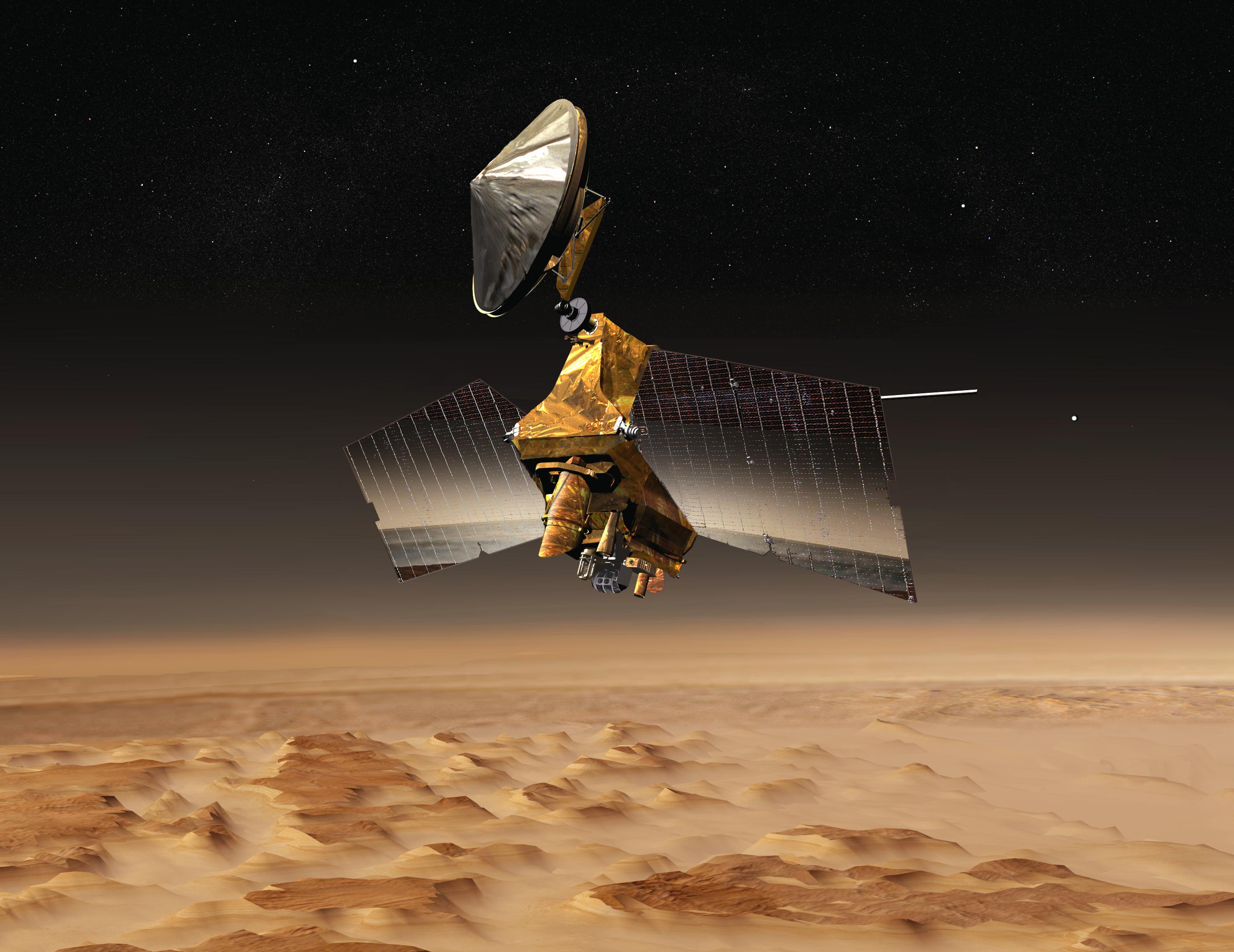
In this animation, the boxy Mars Reconnaissance Orbiter spacecraft is set against the black backdrop of space and the muted orange of Mars.  As the frames progress, the orbiter turns (its solar panels looking like stiff, rectangular wings) to get into position to take images of the martian surface.  The perspective then changes so the viewer is looking at the instrument deck and there is a zoom-in to see the HiRISE camera up close.  The camera looks like a large, cylindrical tube.  The view then changes as if the viewer is seeing Mars through the HiRISE camera.  A large, square area of the surface is highlighted and meant to represent the companion camera's (the context imager) coverage.  A smaller, gray rectangle presents what HiRISE sees.  The view zooms in on the gray area and shows the amazing surface detail that HiRISE allows.  The view pans over many interesting craters and other surface features, ultimately ending on a stunning medium-sized crater. Mars Reconnaissance Orbiter Instrument Pointing Simulation - May 01, 2006

In order to wow us with amazing new views of the Red Planet, Mars Reconnaissance Orbiter must be able to rotate its instrument deck to face its target. This animation features the spacecraft moving to get into position for optimal martian snapshots!

No Audio
QuickTime 4.4 MB   |   MPEG 3.8 MB   |   MPEG-4 2.5 MB
This animation begins with a close-up of Mars Reconnaissance Orbiter's boxy main bus, featuring the science deck where all of the instruments are housed.  The view then zooms in even closer to the MARCI instrument itself.  It is a small camera (compared to HiRISE) that has a lens at the end that resembles a small dust broom.  That design allows the camera to image in wide swaths, covering large areas. Mars Reconnaissance Orbiter Mars Color Imager Instrument Pointing Simulation - May 01, 2006

This animation highlights the first use of the MARCI (Mars Color Imager) camera on Mars Reconnaissance Orbiter.

No Audio
QuickTime 889 kB   |   MPEG 838 kB   |   MPEG-4 419 kB
spacer
Screenshot from the animation 'Mars Reconnaissance Orbiter Launch, Mars Orbit Insertion and Aerobraking Animation' Mars Reconnaissance Orbiter Launch, Mars Orbit Insertion and Aerobraking Animation - March 09, 2006

Follow the journey of NASA's next generation Mars orbiter during its launch, through the vastness of space and as it reaches critical mission milestones. The spacecraft's powerful suite of instruments and their unprecedented capabilities are highlighted.

Part 1
QuickTime 5.9 MB   |   MPEG 5.6 MB   |   MPEG-4 5.5 MB

Part 2
QuickTime 4.9 MB   |   MPEG 5 MB   |   MPEG-4 4.3 MB

Part 3
QuickTime 6.6 MB   |   MPEG 6.4 MB   |   MPEG-4 6.1 MB

Part 4
QuickTime 3.6 MB   |   MPEG 3.6 MB   |   MPEG-4 3.2 MB

Complete Version
QuickTime 21 MB   |   MPEG 21.3 MB   |   MPEG-4 19.8 MB
QuickTime with Caption 20.9 MB

Screenshot from the movie 'A Mars Eye Opener' A Mars Eye Opener - March 06, 2006

The Mars Reconnaissance Orbiter will see things at Mars in greater detail than ever before.

QuickTime with Caption 14.5 MB
Screenshot from the movie 'Next Leap in Mars Exploration' Next Leap in Mars Exploration - March 03, 2006

Mars Reconnaissance Orbiter will bring new capabilities to Mars exploration. The spacecraft arrives at Mars Mar. 10, 2006.

QuickTime with Caption 14.4 MB

  2005
screenshot from the video 'Liftoff is Extraordinary' Liftoff is Extraordinary! - August 12, 2005

The Atlas V launch vehicle lit the morning sky as it rocketed the Mars Reconnaissance Orbiter on its journey to Mars.

RealPlayer with Caption
screenshot from the video 'Launch Coverage Introduction' Launch Coverage Introduction
- August 12, 2005

NASA commentator, George Diller, opens the MRO launch coverage program.

RealPlayer with Caption
Screenshot from the Mars Reconnaissance Orbiter Animation Mars Reconnaissance Orbiter Animation - August 05, 2005
No Audio
QuickTime 9 MB   |   MPEG 7.8 MB   |   MPEG-4 9.5 MB
Mars Reconnaissance Orbiter Animation Mars Reconnaissance Orbiter: Fall 2004 Update
- January 11, 2005

Less than a year before the launch of the largest spacecraft ever sent to Mars, engineers and technicians at Lockheed Martin were busily assembling the spacecraft while engineers and scientists at JPL were moving into their operations space.

QuickTime 6.9 MB   |   MPEG 6.4 MB   |   MPEG-4 5.6 MB
QuickTime with Caption 6.9 MB

  2004
Mars Reconnaissance Orbiter Animation Mars Reconnaissance Orbiter Animation
Full Version
- June 07, 2004

Furthering our global perspective of Mars and its watery past, the Mars Reconnaissance Orbiter is revealing the red planet as never before. After a seven-month cruise to Mars and six months of aerobraking to reach its science orbit, the Mars Reconnaissance Orbiter's instruments have zoomed in for extreme close-up photography of the martian surface, analyzed minerals, looked for subsurface water, traced how much dust and water are distributed in the atmosphere, monitored daily global weather, and surveyed the surface for landing sites for future missions.

QuickTime 9.8 MB   |   MPEG 7.8 MB   |   MPEG-4 4.3 MB
Part 1: Launch to Orbit insertion Mars Reconnaissance Orbiter Animation: Part 1
Launch to Orbit insertion
- June 07, 2004

QuickTime 5.4 MB   |   MPEG 5.2 MB   |   MPEG-4 2.9 MB
Part 2: Aerobraking to Mission Simulation and Objectives Mars Reconnaissance Orbiter Animation: Part 2
Aerobraking to Mission Simulation and Objectives
- June 07, 2004

QuickTime 3.2 MB   |   MPEG-4 1.4 MB   |   MPEG 2.6 MB
Simulation of the Mars Reconnaissance Orbiter Deploying its High-Gain Antenna Simulation of the Mars Reconnaissance Orbiter Deploying its High-Gain Antenna - July 07, 2004

QuickTime (610 kB)   |   MPEG (1.7 MB)   |   MPEG-4 (1.2 MB)
Simulation of the Mars Reconnaissance Orbiter Deploying its Solar Panels Simulation of the Mars Reconnaissance Orbiter Deploying its Solar Panels - July 07, 2004

QuickTime 610 kB   |   MPEG 2.5 MB   |   MPEG-4 1.2 MB


The Challenges of Getting to Mars


Mars is right next door to Earth, but it isn't very neighborly. Two-thirds of all international missions have failed, but an undaunted human spirit and hard work keep us on a path to explore Mars - a world so much like our own, but much more hostile and uninviting. In this Challenges of Getting to Mars web series, Mars Reconnaissance Orbiter team members describe demanding mission stages associated with the largest vehicle to go to Mars since Viking in the 1970s. Chapters include: transporting the orbiter across the country, preparing it for its journey and conducting a successful launch. Future episodes will include the challenges of navigating the spacecraft, entering the martian atmosphere, slowing down to achieve the spacecraft's science orbit (aerobraking) and collecting vital, high-resolution Mars data.

Screenshot from the movie 'The Challenges of Getting to Mars: Dip and Drag' The Challenges of Getting to Mars: Dip and Drag - April 03, 2006
With the spacecraft safely captured into orbit, the Mars Reconnaissance Orbiter team transitions to the next critical phase -- aerobraking. Learn how engineers slow the spacecraft and precisely shape its orbit using the dynamic atmosphere of Mars.
QuickTime 8.2 MB
MPEG 11.7 MB
MPEG-4 10.4 MB
QuickTime with Caption 8.2 MB
Screenshot from the movie 'The Challenges of Getting to Mars: Burn and Capture' The Challenges of Getting to Mars: Burn and Capture - March 07, 2006
After millions of miles, dozens of tests, a handful of calibrations and a number of "dress rehearsals," the Mars Reconnaissance Orbiter arrives at the red planet on March 10, 2006. Find out how engineers prepare the spacecraft and themselves for this complicated engine burn and capture into Mars' orbit.
QuickTime 9.9 MB
MPEG 12.1 MB
MPEG-4 9.5 MB
QuickTime with Caption 9.9 MB
Watch the movie 'Challenges of Getting to Mars: Hitting the Bull's-Eye' The Challenges of Getting to Mars: Hitting the Bull's-Eye - February 24, 2006
Hitting a moving target over 306 million miles away is no easy feat. Learn how JPL navigation engineers have guided the Mars Reconnaissance Orbiter toward its mission-critical capture into orbit around the red planet.
QuickTime 8.9 MB
MPEG 11.5 MB
MPEG-4 8.6 MB
QuickTime with Caption 8.9 MB
Watch the movie 'The Challenges of Getting to Mars:  Launch Logistics' The Challenges of Getting to Mars: Launch Logistics - October 12, 2005
The logistical challenge of getting a mission sent to Mars begins years before liftoff and culminates in the stressful days just prior to launch. This video highlights teams at JPL, Kennedy Space Center and Lockheed Martin working together to prepare for a complex launch amid the ever-changing weather of August in Florida.
QuickTime 7.1 MB
MPEG 12.3 MB
MPEG-4 7.5 MB
QuickTime with Caption 7.2 MB
Watch the movie 'The Challenges of Getting to Mars - Getting to the Launch Pad' The Challenges of Getting to Mars: Getting to the Launch Pad - August 5, 2005
From one side of the country to the other, through a snowstorm and other delays, the Mars Reconnaissance Orbiter made its way to Kennedy Space Center in Florida for final processing and rehearsals before launch. Hitch a ride on the C-17 cargo plane that carried the next generation of Mars explorers to its final Earth-bound destination.
QuickTime 7.4 MB
MPEG 10.5 MB
MPEG-4 6.4 MB
QuickTime with Caption 7.4 MB
Watch the movie 'The Challenges of Getting to Mars - Heavy Lifting' The Challenges of Getting to Mars: Heavy Lifting - April 18, 2005
Getting a spacecraft to Mars is no walk in the park - as launch engineers are well aware. But when the spacecraft in question is among the largest ever sent to the red planet, there are specific challenges that must be overcome. Hear from the Mars Reconnaissance Orbiter team just what it will take to get the mission on its way.
QuickTime 8.7 MB
MPEG 8.2 MB
MPEG-4 7.7 MB
QuickTime with Caption 8.8 MB
Credits Feedback Related Links Sitemap
USA Gov
NASA Logo