NASA Ames Research Center
Moffett Field, Calif.
NASA STUDY SHOWS HOW WATER MAY HAVE FLOWED ON ANCIENT MARS
|
NASA scientists have discovered how an intricate martian network of streams, rivers and lakes may have carried water across Mars.
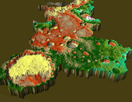
Vertically exaggerated 3-D image of Flaugergues basin showing extensive dissected terrain in upland regions draining into depressions, and smooth, possibly lakebed features of the depressions. |
Using new three-dimensional data from the Mars Global Surveyor spacecraft
and a powerful state-of-the-art computer code that 'models' overland
water flow, scientists visualized the complex flow of martian water.
These data, acquired by the laser altimeter on board the spacecraft,
provided highly accurate, three-dimensional topographic views of Mars.
"We've known for some time that Mars contains lakebed and
stream-like surface features, and that many of these stream features run
into depressions, then end abruptly," said Marc G. Kramer, a visiting
National Research Council scientist at NASA Ames Research Center in
California's Silicon Valley. Kramer is principal author of a peer-reviewed
news article about the study that recently appeared in EOS, a weekly
American Geophysical Union publication. "A new aspect of this study
shows how these two features link to one another as a single, integrated
water network that may have existed on Mars at some time in the past,"
he said.
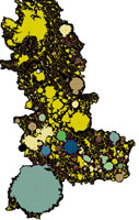
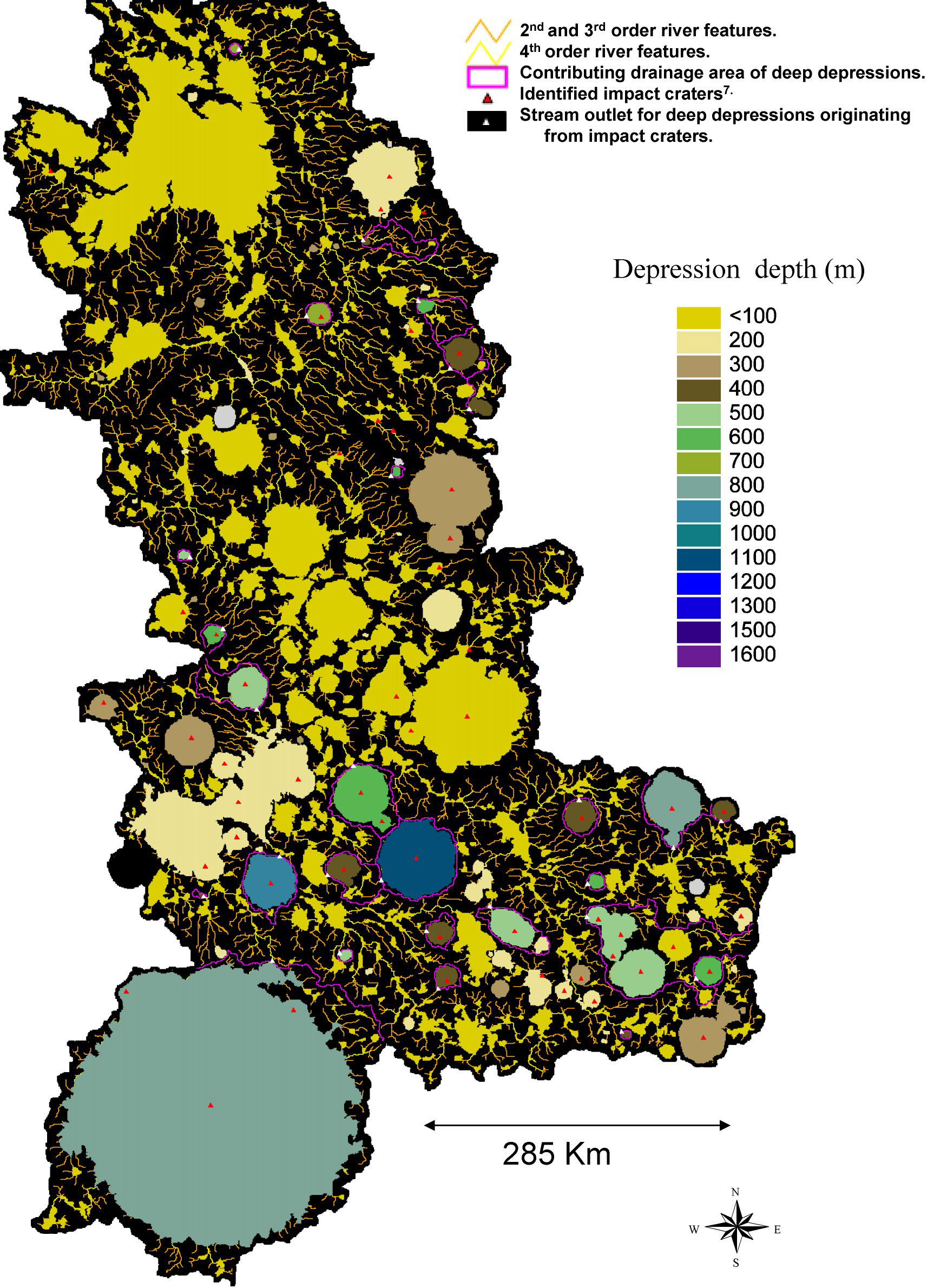
River segments and depth of depressions in Flaugergues drainage basin (named after the large Flaugergues crater (16.8S 19.2E) in the upper portion of the catchment). Surface water may have drained from Flaugergues into Schiaparelli Crater through a main channel system. Limited contributing drainage area for deep depressions, which are not likely to have been part of the main channel system are shown in pink. Known impact craters on the surface are shown in white. |
The study spans portions of the equatorial region on the martian highlands
that extend from the northern mid latitudes to the southern mid latitudes.
Kramer's co-authors are Christopher Potter, David Des Marais and David
Peterson, all from NASA Ames.
Scientists have long been puzzled as to why some ancient river-like
features on the red planet do not seem to connect to one another and
often lack smaller stream features.
"If you look at a photograph of the surface of Mars, the river features
begin and end abruptly, and often lack small-scale features," Kramer said.
"Many scientists have argued that these features were formed from
localized groundwater seeping to the surface. Others have argued that
these features formed from precipitation during a time when Mars may
have had a thicker atmosphere."
"What we found in this study, is that many of these apparently
fragmented river features may have connected or flowed into depressions
that resemble ancient lake beds," Kramer explained. "Some of the
larger depressions are comparable in size to the Great Lakes in
North America in terms of surface area."
In addition, some of the larger depressions of the main channel system
are comparable in volume to Lake Erie, the smallest of the Great Lakes
in North America, Kramer added.
Large lakes and rivers on Mars once may have formed water systems
that included many streams and smaller lakes, according to the scientists.
The study found that the areas near the Great Lakes on Earth bear a
strong resemblance to features on Mars. Although the areas appear to
be similar, they formed in different ways, according to Kramer.

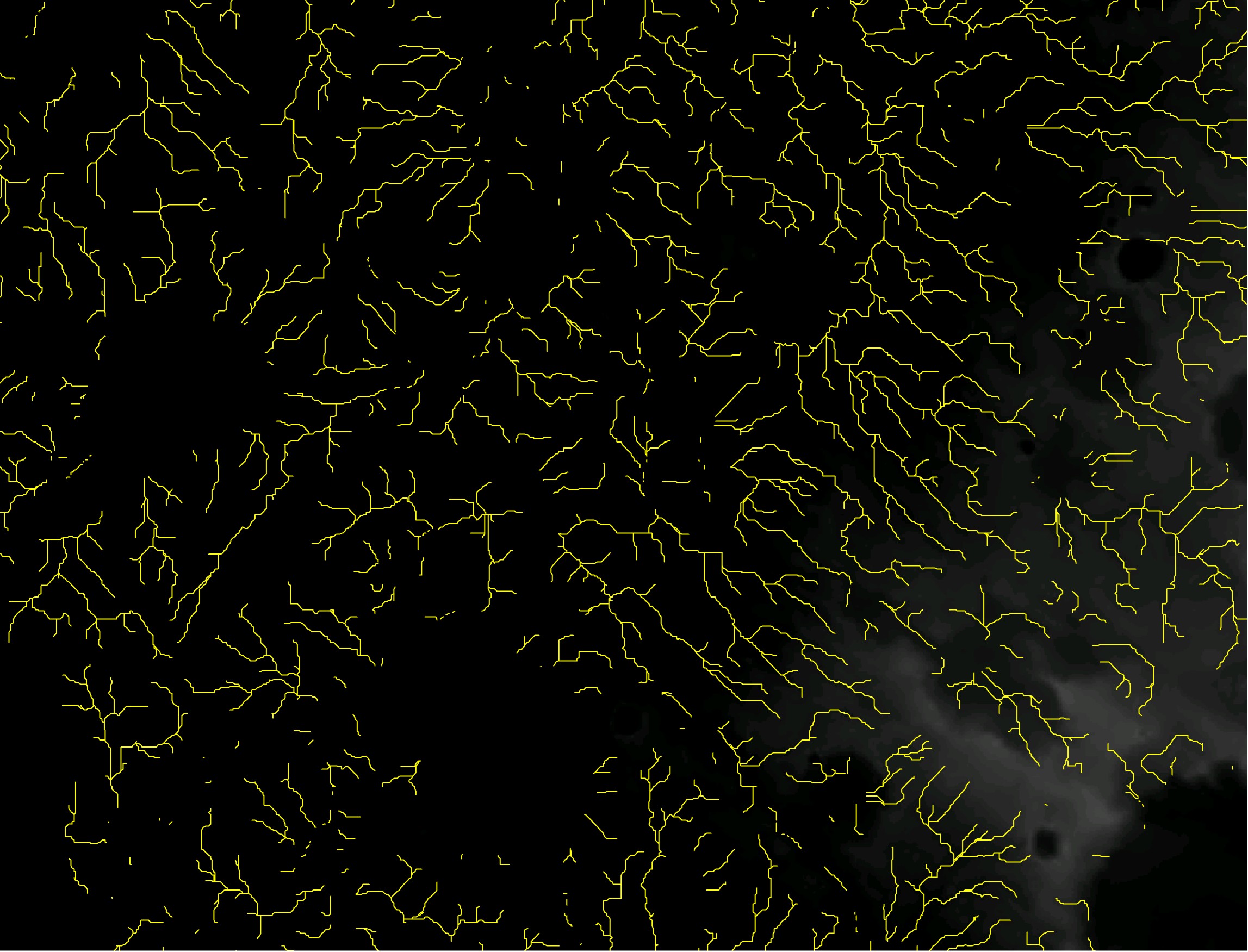
Discontinuous stream network. Many stream features feeds from one depression feature into the next on Mars. |
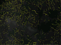
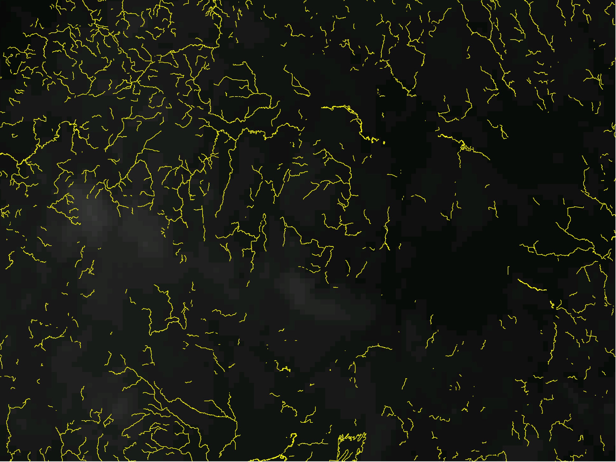
Discontinuous stream network which connects to Great Lakes water system and is analogous to the martian stream features in the highlands. |
The study of surface depressions in conjunction with river features,
provides a more complete picture of a surface water network that may
have existed on what must have been a warmer early Mars, according
to Potter. The researchers excluded fresh impact crater areas during the
analysis in order to study older drainage patterns.
"The larger shallow depressions in the main channel system often
contain multiple, highly eroded craters and show evidence of stream
features in the extensive upland regions draining into them," Kramer said.
These depressions become increasingly shallow downstream, suggesting
that increased sedimentation may have been deposited by water or ice
that once may have flowed through them, according to the scientists.
"Still unclear is how long such a water system may have persisted,
and under exactly what climate conditions," he said. "The answers to
these questions may lie in further examination of the sediments that
have accumulated across the depressions of the surface water network."
"New instruments on the Mars Odyssey spacecraft, including the
Thermal Emission Imaging System (THEMIS) instrument, address these
questions," Kramer said. THEMIS infrared and visible light images have
revealed a diversity of surface types and features. Nighttime temperature
images show complex patterns of rock layers, rocky debris, sand and dust
produced by impact cratering, wind erosion, volcanism and deposition.
"The data coming out of the Mars Global Surveyor and Mars Odyssey
Mission are quite revealing," Kramer said. "We were able to study the
planet in ways that were previously not possible."
"With an abundance of ice recently detected just below the surface
of Mars, the possibility that life has existed or still may exist may hinge
on its past climate and the duration of surface water flows," Potter said.
"Was Mars ever a warm and wet planet, or has it always been cold and
dry?" he asked.
The Jet Propulsion Laboratory, Pasadena, Calif., manages the Mars
Global Surveyor and Mars Odyssey missions. The NASA Astrobiology
Institute, based at NASA Ames, funded the study that resulted in the
peer-reviewed article. Publication size images are available at:
http://amesnews.arc.nasa.gov/releases/2003/03images/marslake/marslakes.html
View this pressrelease at the NASA Ames Research Center.
###