Mars
Odyssey
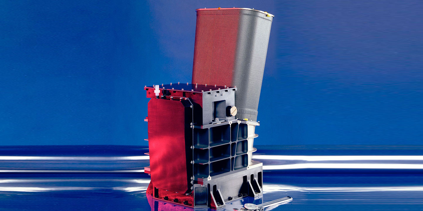
The Thermal Emission Imaging System, called THEMIS, views the visible and infrared reflections from the Martian surface to make a map showing the location of different mineral concentrations and their relationship to various landforms.
| Main Job | To determine the distribution of minerals on the surface of Mars. |
| Location | On the body of the orbiter |
| Mass | 24.7 pounds (11.2 kilograms) |
| Power | 14 Watts |
| Data Return | IR ImagerInstantaneous internal rate of 1.17 Mbits/sec. Data rate to spacecraft after real-time compression is 0.6 Mbits/sec.Visible ImagerInstantaneous internal rate of up to 6.2 Mbits/sec. Data rate to spacecraft is <1.0 Mbits/sec. |
| Color Quality | 5 visual bands0.425 microns, 0.540 microns, 0.654 microns, 0.749 microns, 0.860 microns.10 infrared bands6.78 microns (used twice), 7.93 microns, 8.56 microns, 9.35 microns,10.21 microns, 11.04 microns, 11.79 microns, 12.57 microns, 14.88 microns. |
| Image Size | Visible camera has a 1024 x 1024 pixel array with 5 filters. IR focal plane has 320 cross-track pixels and 240 down-track pixels covered by 10˜1-μm-bandwidth strip filters in nine different wavelengths. |
| Image Resolution | Visual images 59 feet (18 meters) per pixel Infrared images 328 feet (100 meters) per pixel |
| Focal Length | ~7.8 inch (20 centimeter) effective focal length |
| Focal Ratio | f/1.6 |
| Filed of View | IR imager 4.6 degree (80 mrad) cross-track by 3.5 degree (60 mrad) down-track FOV with a 0.25 mrad (100 m) IFOV at nadir. Visible imager 2.66 degree (46.4 mrad) cross-track by 2.64 degree (46.1 mrad) down-track FOV with 0.045 mrad (18 m) IFOV in 1024 x 1024 pixels at nadir. The two imagers are spatially bore-sighted. |
By looking at the visible and infrared parts of the spectrum, THEMIS is determining the distribution of minerals on the surface of Mars and helping scientists understand how the mineralogy of the planet relates to the landforms.
A word from THEMIS' lead scientist
During the martian day, the sun heats the surface. Surface minerals radiate this heat back to space in characteristic ways that can be identified and mapped by the instrument. At night, since it maps heat, the imager searches for active thermal spots.
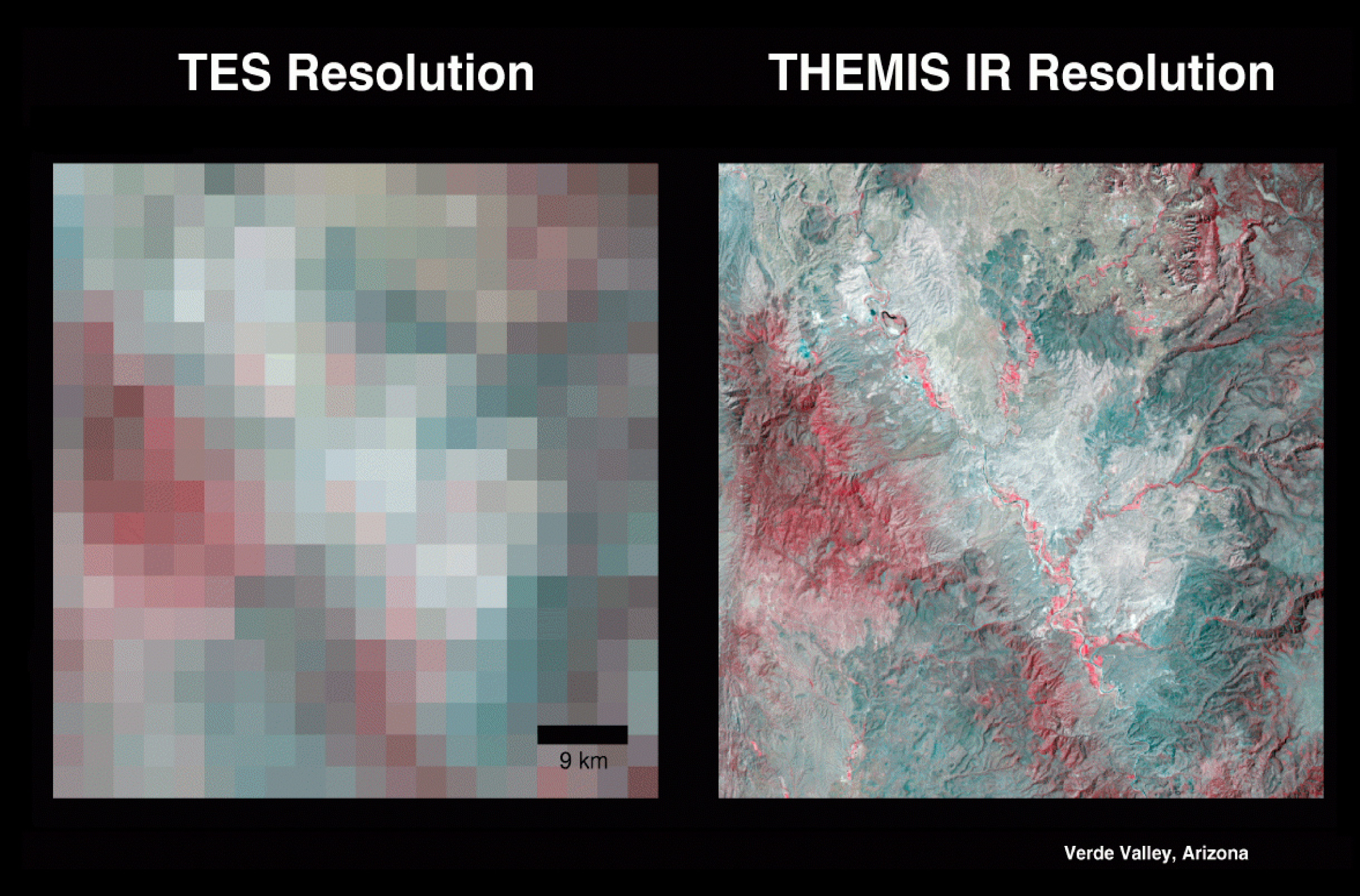
In the infrared spectrum, the instrument uses 9 spectral bands to help detect minerals within the martian terrain. These spectral bands, similar to ranges of colors, can obtain the signatures (spectral "fingerprints") of particular types of geological materials. Minerals, such as carbonates, silicates, hydroxides, sulfates, hydrothermal silica, oxides and phosphates, all show up as different colors in the infrared spectrum. This multi-spectral method allows researchers to detect in particular the presence of minerals that form in water and to understand those minerals in their proper geological context. THEMIS' infrared capabilities have significantly improved the data from TES, a similar instrument on Mars Global Surveyor.
The instrument's multi-spectral approach also provides data on localized deposits associated with hydrothermal and subsurface water and enables 100-meter (328-feet) images of martian terrain to be captured in each pixel, or single point, of every image.
ASTER, an Earth orbiting instrument on the Terra spacecraft, has used a similar approach to map the distribution of minerals here on Earth.
Variations in the thermal infrared "color" in the right-hand image are due to differences in the kinds of minerals that make up rocks and soil. In the visible part of the spectrum that our eyes can see (left-hand image), it would not be apparent what minerals are present.
The part of the imaging system that takes pictures in visible light is able to show objects about as big as a semi-truck. This resolution helps fill in the gap between large-scale geological images from the Viking orbiters in the 1970s and the very high-resolution images from the currently orbiting Mars Global Surveyor.
For more information, visit the THEMIS instrument site at Arizona State University.