Images
Exposing the Rock in Impact Craters
February 05, 2019
Map Projected Browse Image
Click on image for larger version
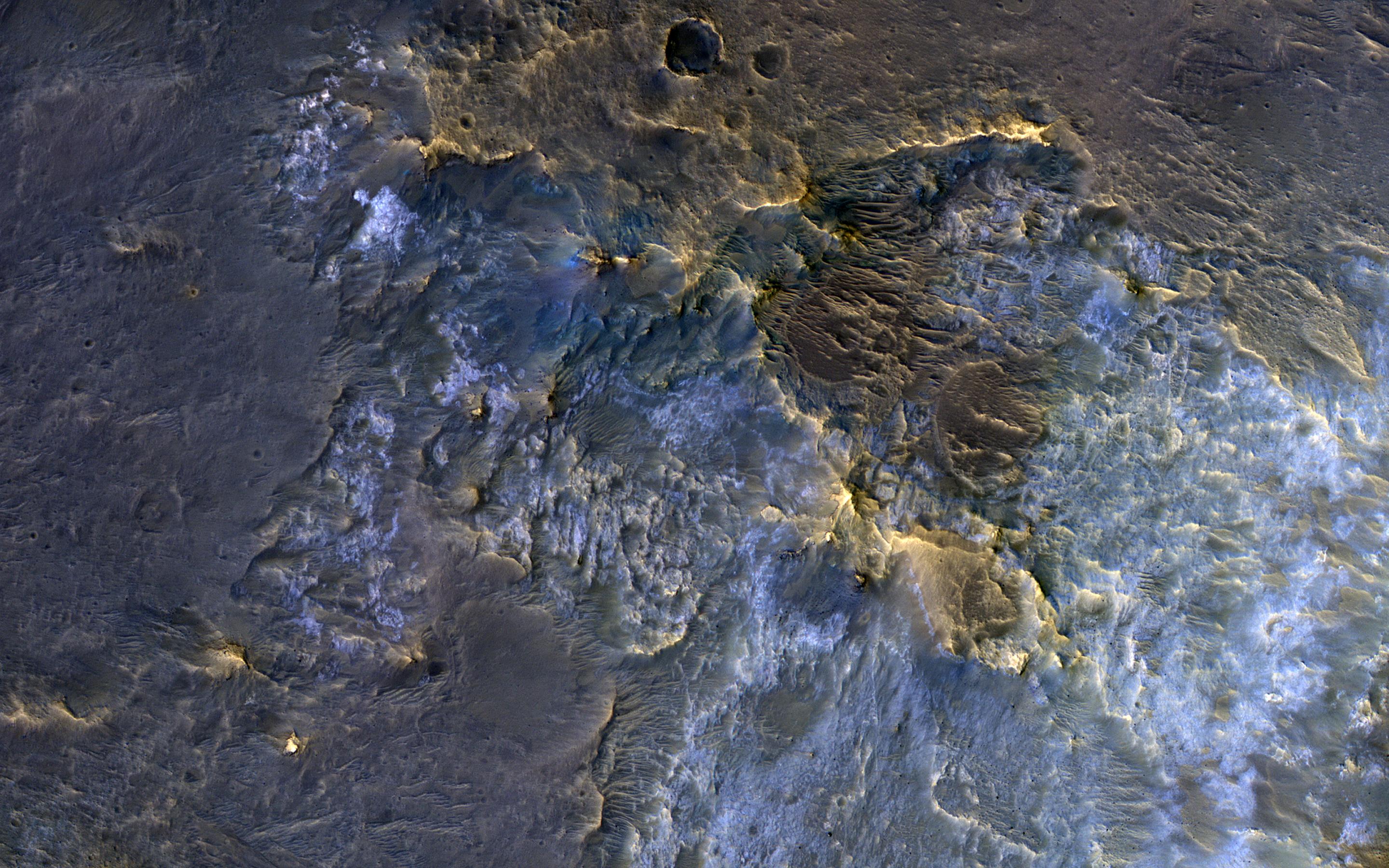
In this complex crater (about 44-kilometers in diameter), we see bedrock in several locations from different depths in the crust. The central uplift exposes large fragments of green-toned bedrock that possibly originated from several kilometers beneath the surface.
To the south of the crater, we see more of this bedrock along with material that was excavated and thrown out after the impact. In craters of this size, the rim is unstable and collapses inwards forming terraces, which occasionally exposes more bedrock that would have originated from close to the surface than the rocks exposed within the uplift itself. Central uplifts have better exposures of bedrock, but in this example the terraces steal the show, displaying beautiful green- and light-toned bedrock at multiple locations.
The map is projected here at a scale of 50 centimeters (19.7 inches) per pixel. [The original image scale is 53.4 centimeters (21.0 inches) per pixel (with 2 x 2 binning); objects on the order of 160 centimeters (63.0 inches) across are resolved.] North is up.
This is a stereo pair with ESP_057932_1670.
The University of Arizona, Tucson, operates HiRISE, which was built by Ball Aerospace & Technologies Corp., Boulder, Colorado. NASA's Jet Propulsion Laboratory, a division of Caltech in Pasadena, California, manages the Mars Reconnaissance Orbiter Project for NASA's Science Mission Directorate, Washington.
Credits
NASA/JPL-Caltech/University of Arizona