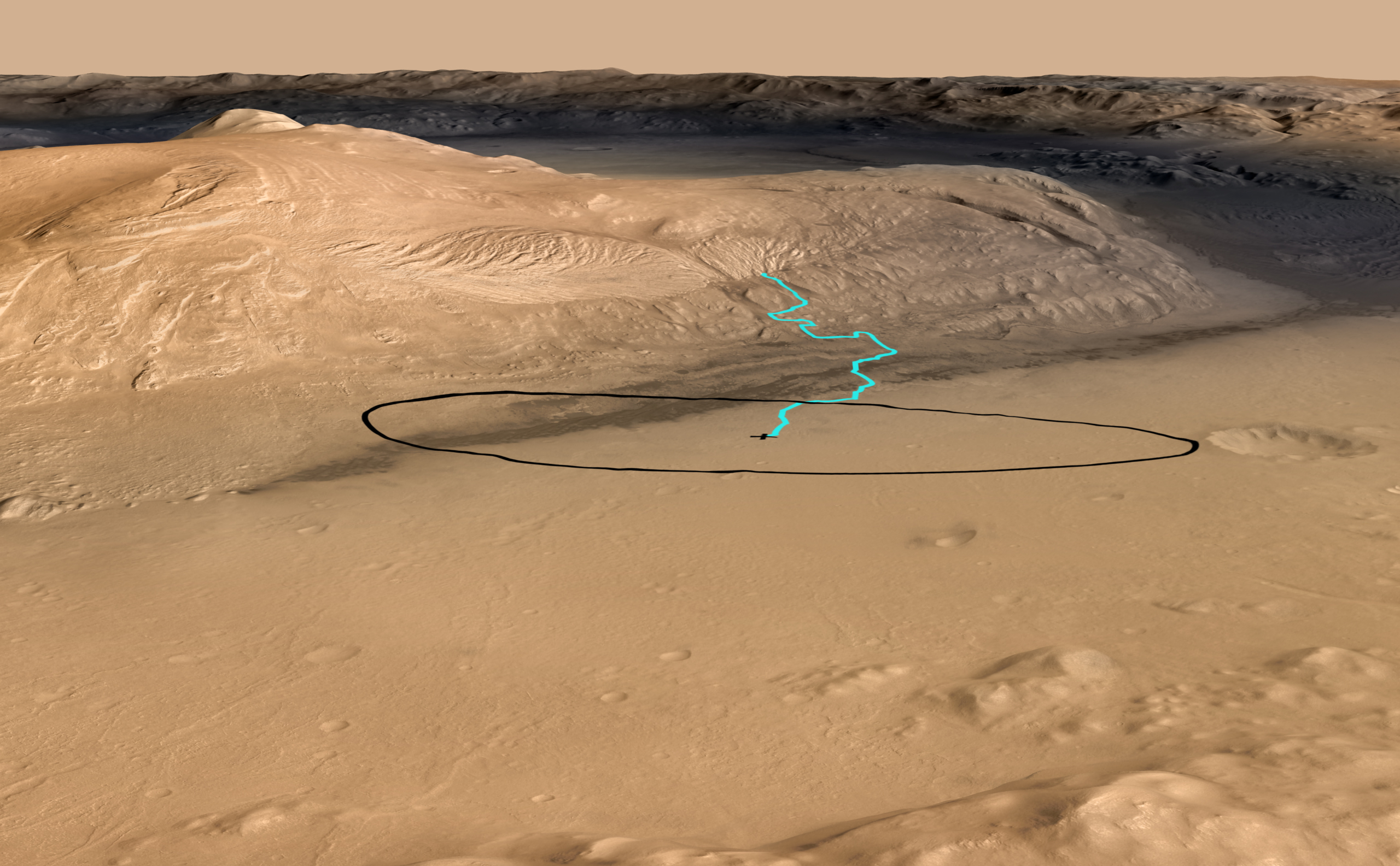
Target for Start of Driving by Mars Rover Curiosity

| Credit | NASA/JPL-Caltech/ESA/DLR/FU Berlin/MSSS |
|---|---|
| Language |
|
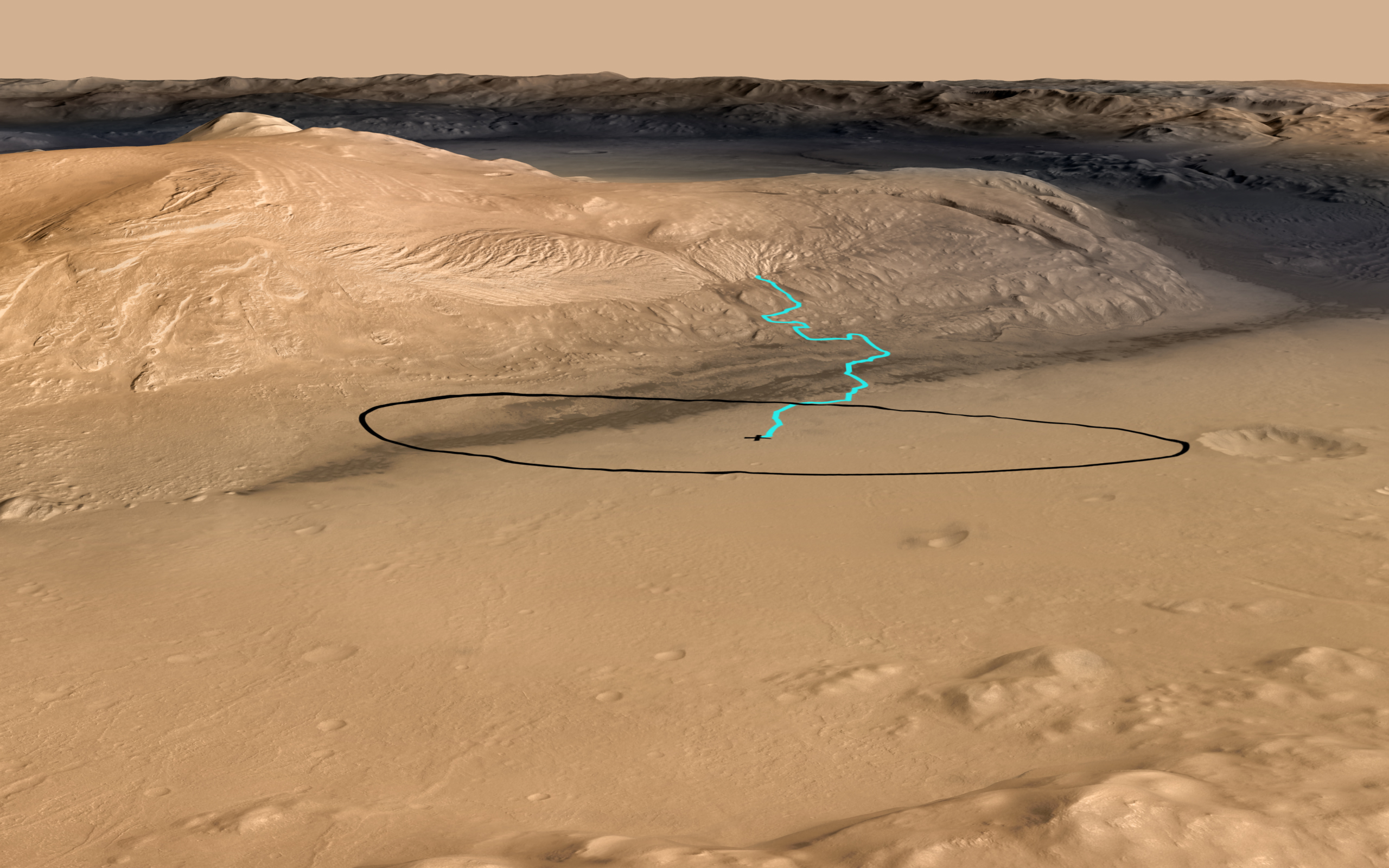
As of June 2012, the target landing area for Curiosity, the rover inside NASA's Mars Science Laboratory spacecraft, is the ellipse marked in black on this image. The ellipse is about 12 miles long and 4 miles wide (20 kilometers by 7 kilometers).
If landing is successful, Where the rover lands will also be where it starts driving after some days of initial characterization activities at the landing site. The blue line indicates a potential route for driving to geological destinations identified from orbit. The actual route during the two-year prime mission will depend on where the rover lands within the ellipse and on decisions to be made by scientists and engineers after the landing. Landing will be the evening of Aug. 5, 2012, Pacific Daylight Time (early Aug. 6 Universal Time and Eastern Time).
The site is near the northern flank of Mount Sharp, inside Gale Crater on Mars. This oblique view of Mount Sharp is derived from a combination of elevation and imaging data from three Mars orbiters. The view is looking toward the southeast.
The image combines elevation data from the High Resolution Stereo Camera on the European Space Agency's Mars Express orbiter, image data from the Context Camera on NASA's Mars Reconnaissance Orbiter, and color information from Viking Orbiter imagery. There is no vertical exaggeration in the image.
NASA's Jet Propulsion Laboratory, a division of the California Institute of Technology, Pasadena, manages the Mars Science Laboratory mission for the NASA Science Mission Directorate, Washington.

