| Southern Hemisphere Polygonal Patterned Ground
On Earth, periglacial is a term that refers to regions and
processes where cold climate contributes to the evolution of
landforms and landscapes. Common in periglacial environments on Earth,
such as the arctic of northern Canada, Siberia, and Alaska, is a
phenomenon called patterned ground. The "patterns" in
patterned ground often take the form of large polygons, each
bounded by either troughs or ridges made up of rock particles
different in size from those seen in the interior of the polygon. On
Earth, many polygons in periglacial environments are directly linked
to water: they typically form from stresses induced by repeated
freezing and thawing of water, contraction from stress induced by
changing temperatures, and sorting of rocks brought to the surface
along polygon boundaries by the freeze-thaw processes. Although not
exclusively formed by freezing and thawing of water, that is often the
dominant mechanism on Earth.
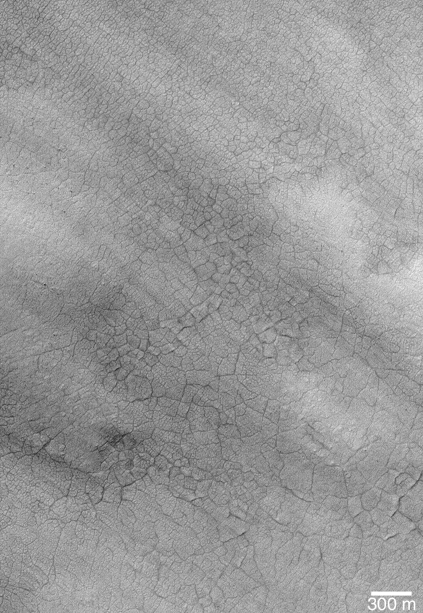
Polygons similar to those found in Earth's arctic and antarctic
regions are also found in the polar regions of Mars. Typically, they
occur on crater floors, or on intercrater plains, between about
60° and 80° latitude. The polygons are best seen when
bright frost or dark sand has been trapped in the troughs that
form the polygon boundaries. Three examples of martian polygons
seen by the Mars Global Surveyor (MGS) Mars Orbiter Camera (MOC)
are shown here. Each is located in the southern hemisphere:
(a) Polygon troughs highlighted by frost as the south polar cap retreats
during spring. The circular features are the locations of buried
craters that were originally formed by meteor impact. This image,
E09-00029, is located at 75.1°S, 331.3°W, and
was acquired on 1 October 2001.
(b) Summertime view of polygons, highlighted by dark, windblown sand,
on the floor of a crater at 71.2°S, 282.6°W. The image,
E12-02319, was obtained on 21 January 2002.
(c) Polygon troughs highlighted by the retreating south polar frost cap
during southern summer near 80.7°S, 70.4°W. This picture,
M11-01795, was taken by MOC on 13 January 2000.
Some Mars researchers assume that polygons on the Red Planet are key
indictors that ground ice is present or was present in the recent
past. However, whether these polygons actually required water ice to
form is, in fact, unknown, since dry processes are also known on Earth
for form similar polygons.
Photo Credit: NASA/JPL/Malin Space Science Systems
|